New Street, Corporation Street, Steelhouse Lane, Colmore Row – 1963-1964
An exploration of the area of the City Centre bounded by New Street, Corporation Street, Steelhouse Lane, and Colmore Row. Subjects include: Eden Place, Waterloo Street, Bennett's Hill, Newhall Street, St Philip's Cathedral, Temple Row West, Ethel Street, Stephenson Street, Navigation Street, Lower Temple Street, Temple Street, Temple Passage, Hinkley Street, Needless Alley, Cherry Street, Cannon Street, Cannon Passage, Church Street, Livery Street, Snow Hill Station, Snow Hill, Bull Street, The Minories, Slaney Street, Weaman Street, Whittall Street, Loveday Street, Lancaster Street, Coleridge Passage, Newton Street, Old Square, Upper Priory, Fore Street. This selection consists of 42 images scanned mainly from original 35 mm colour and monochrome transparencies.
The maps below, published in 1949 and 1972, show the approximate area covered by the survey and identify many of the relevant street names. The later map shows the new roadways created as part Inner Ringroad development in the early 1960s.
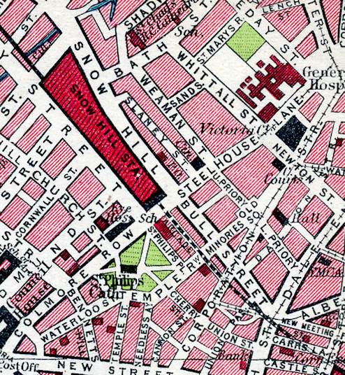
From Bartholomew's Pocket Atlas and Guide to Birmingham (1949)
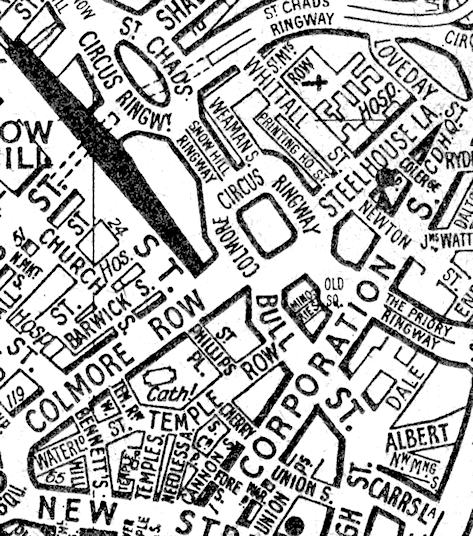
From Geographer's Birmingham A-Z (c.1972)