Queensway Tunnel (1969); James Brindley Walk (1969); Handsworth & Winson Green (1959-81); Handsworth Wood, Hamstead & Great Barr (circa 1937)
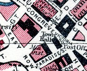
From Bartholomew's Pocket Atlas and Guide to
Birmingham (1949)

From Geographer's Birmingham A-Z (c.1972)
This selection includes: the excavations for Queensway Tunnel between Congreve Street, Paradise Street, and Easy Row; the development of James Brindley Walk alongside the canal southwest of Summer Row; scenes in Handsworth and Winson Green; and four shots of Handsworth, Handsworth Wood, Hamstead and Great Barr, taken around 1937. The selection comprises 31 images scanned from original 35 mm colour transparencies, colour and monochrome prints, and 35 mm monochrome negatives. The last nine images in the series are scans of original 3" × 2" contact prints made from negatives produced in the 1930s by my father, Leonard Ball.
The two small maps (above left and right), published in 1949 and 1972, show the approximate area covered by the Queensway Tunnel series. Below the strip of thumbnail images are two large maps, published in 1949, showing the Handsworth Wood, Hamstead and Great Barr area and the Handsworth and Winson Green areas of northwest Birmingham.

