Images of Wales
Where's that?? - locate Crai Reservoir on a map of South Wales.
The Cnewr Estate, the Tower, and Crai Reservoir
Breconshire
Photography by John Ball - 7 December 2003
(with a Fuji FinePix S602 Zoom digital camera)
I visited Cnewr Farm and its surrounding lands on a sunny but very cold day in December. The visit was prompted by research into the Brecon Forest Tramroads, which were developed 185 years ago in what is now part of the Brecon Beacons National Park. The tramroads were constructed to develop some of the vast isolated upland wastes released for speculative development by a hard-pressed government to raise funds for the Napoleonic Wars.
The Brecon Forest Tramroad was envisaged as an adjunct to the agricultural development of rural mid-Wales by the visionary Scottish merchant John Christie who bought the land from the government in 1819. The horse-drawn trams (wagons) would carry minerals and limestone on metal rails. Unfortunately Christie's immense wealth did not save him from a decline into bankruptcy, but renewed investment from London, and the expanding iron and tinplate manufacturing industries in the Swansea Valley enabled the tramroads to continue to function for nearly 50 years.
Page 1 (below) Page 2
Cnewr Farm
Cnewr Farm was a key part of Christie's tramroad. When first built, it housed a large range of lime-sheds linked by rail to the nearest source of limestone three miles to the south at Penwyllt and Pwll Byfre.
 |
| Above: Cnewr farm buildings, constructed in 1821. The house on the left is a later addition. The architecture of the combined railway depot and farm at Cnewr was a simpler version of the grand design of the ironworks stables at Dowlais in Glamorgan, which had been built in 1820. |
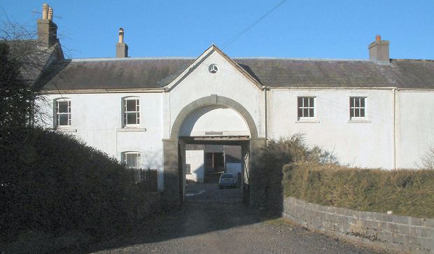 |
| Above: Archway giving access to the inner courtyard at Cnewr. |
 |
| Above: View into the courtyard at Cnewr. The building shown above was originally a wool store. Out of sight on the left were lime-sheds, while on the right were stables. The tramroad railway entered through the central archway. |
 |
| Above: The keystone in the supporting arch bears the inscription J. C. (John Christie), the date 1821, and a wagon-wheel symbolising the link with the Brecon Forest Tramroad. John Christie died of typhoid aged 83 in 1857 and is buried in Hackney, north London. |
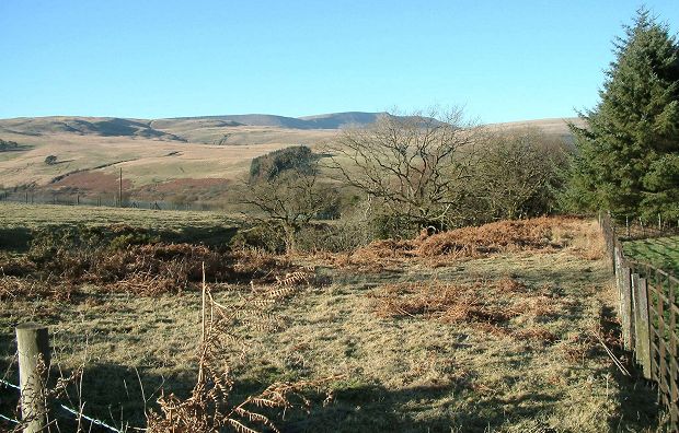 |
| Above: View westwards from Cnewr towards the 2,600-foot Fan Hir (the long peak). |
 |
| Above: View south-westwards from Cnewr towards to head of the Crai Valley. |
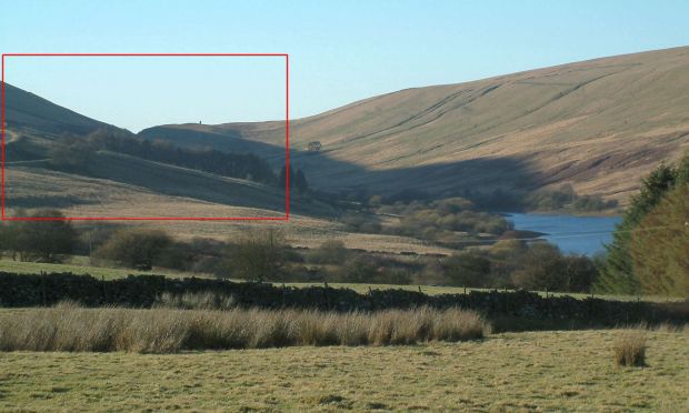 |
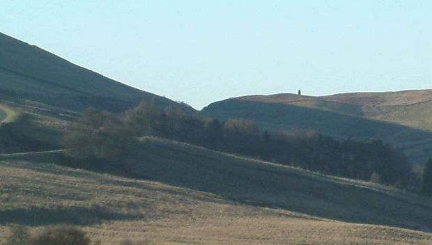
Above: View approaching the Bwlch (gap) between the mountains at the top of
the Crai Valley. Crai Reservoir is on the right.Below: This enlarged detail from the previous picture shows a tower on the horizon, a landmark clearly visible on the approach to the highest point of the A4067 road which then descends into the Swansea Valley. |
Continue the exploration of the Cnewr Estate on Page 2
|